
Ceredigion, Wales, UK
Created | Updated Nov 24, 2009
Located in the mid-west of Wales, Ceredigion is one of the few Welsh counties that has the same name in both English and Welsh. It is in the middle of Cardigan Bay, bounded to the west by the Irish Sea. It has borders with Gwynedd to the north, Powys to the east, Carmarthenshire to the south and Pembrokeshire to the south-west. Historically the area is known as Cardiganshire. In fact, it is sometimes still referred to by this name.
The east of the county is largely occupied by the Cambrian Mountains, with the highest point at Plynlimon (752m/2,467ft). Its name is an Anglicisation of Pumlumon, meaning 'five peaks' (the five peaks which make up the Plynlimon massif). This is the source of the UK's longest river, the Severn. The River Teifi is the county's major watercourse, forming the southern border for much of its length.
When you look at a road map of the county, you will be struck by the absence of major roads. A main coastal road and a few other A-roads snaking across the land, but it is mostly a maze of small rural roads. This can be confusing to the outsider, or simply inconvenient to the resident. It makes transportation of any type rather slow when compared to the more metropolitan areas.
The stereotypical Cardi (resident of Ceredigion) is the butt of many jokes (affectionate or otherwise), especially in south Wales. Cardis are supposedly extremely tight with their money, and will go to any lengths to economise. Ceredigion is one of the main bastions of the Welsh language and traditional culture; only Gwynedd and Anglesey have a higher percentage of Welsh speakers.
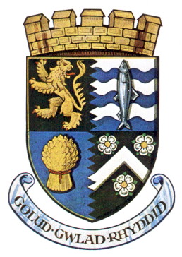
Coat of Arms
The coat of arms combines four symbols from the county's cultural history. The top-left quarter, a golden lion rampant on a black background, is based on the arms of Gwaithfoed1, a medieval prince of Ceredigion. The top-right quarter contains a herring against a background of the sea, signifying the fishing industry. The wheat sheaf in the bottom-left quarter represents the dominant industry of agriculture. Shown on the bottom-right quarter are the arms of Dewi Sant (Saint David), the Patron Saint of Wales, who had very close associations with Ceredigion.
The county's motto is Golud Gwlad Rhyddid2, approximately translated as 'Rich Land of Freedom'.
History
Iron Age
The Celts came to Britain in around 900 BC, and their culture had spread across the whole of the British Isles by 500 BC. There was no one Celtic nation - instead, a number of tribes claimed territories. Most of Ceredigion was under the control of the Demetae3 by the time the Romans invaded in 43 AD.
The Romans
By 78 AD the whole of Wales had come under Roman rule. The areas of greatest Roman influence were in the east of the country, so Ceredigion has comparatively few marks of Roman occupation. Though the area was nominally under Roman control, their grip was tenuous. There were forts nearby, such as the one at Moridunum (Carmarthen), but these were the most westerly of Roman military outposts. The tribes of the west were largely left alone and kept themselves to themselves.
When the Romans left in 410, their cultural influence remained. Roman culture was more evident in the east, and the people of what is now Ceredigion kept largely to their own Celtic British ways. The people that inhabited the abandoned provinces of Britannia were known as the Romano-British, but the west was far less Romanised than the south and east.
Sub-Roman Ceredigion
Demetia resurfaced after the Romans left, though now it was heavily influenced by the Irish. Though they were also Celts, the Irish considered themselves superior to the Britons, since they had never been conquered by the Romans. They began to migrate4 (sometimes peacefully, sometimes not) to the western areas of mainland Britain, and colonised parts of Demetia.
Demetia did not play a prominent part in external affairs. It was not a particularly powerful kingdom when compared to Gwynedd in the north and Powys in the east. Nor did it share a border with the Angles, Saxons and Jutes who began to make inroads into modern England in the 4th and 5th Centuries, although it may have sent some troops against them as part of the occasional alliance of British kingdoms. The general lack of contact with the Sais5 meant the Demetians had to find someone else to fight, and they usually contented themselves with raiding across the border into Powys or the small southern kingdom of Siluria.
In the later 5th Century Cunedda6, the great king of Gwynedd, led campaigns to ward off Irish colonists. His son, Ceredig, helped him in wresting control of a large part of Demetia from the Irish. It was named Ceredigion in his honour.
The Middle Ages
But the old Ceredigion was not to last. In the late 7th Century King Seisyll7 took by force an area known as Ystrad Tywi (much of what is now Carmarthenshire) from the Kingdom of Dyfed. The enlarged kingdom was named after him: Seisyllwg. The medieval Welsh seemed quite partial to renaming their kingdoms. Later on in the 10th Century King Hwyel Dda ('the Good') of Demetia (also known as Dyfed) united his kingdom with Seisyllwg, forming yet another kingdom going by the name of Deheubarth8. Hwyel went on to take control of Gwynedd as well, uniting a large part of Wales under one King. But after his death Hwyel's sons lost Gwynedd to the kingdom's native dynasty.
For a short period in the 12th Century Deheubarth was the most powerful kingdom in medieval Wales. In 1176 King Rhys ap Gruffydd held a festival of poetry and song, to celebrate a treaty with the Normans of England, at his court at Cardigan - the first Eisteddfod. Since then the Eisteddfod has become an important part of the Welsh national identity. Eisteddfods are basically talent contests, conducted mostly in Welsh, ranging from competitions in schools to the one at national level. Rhys had already given Cardigan the first Welsh-built stone castle (remains of which stand to this day). Deheubarth prospered. However, in 1197 the kingdom was split between Rhys's sons. There followed a steady decline in power as Rhys's sons fought for control, until the Norman English took control of the whole of Wales in the 13th Century.
In 1282, King Edward I of England crowned his conquest with a vast network of castles, such as the one at Aberystwyth, to keep the Welsh subdued. Wales essentially became part of England, and was divided into English-style counties. 'Ceredigion' was Anglicised to 'Cardigan' and the area, corresponding pretty closely to the modern county, became known as Cardiganshire.
Twm Sion Cati
Dubbed 'The Welsh Robin Hood', Twm Sion Cati9 (real name Thomas Jones) was born near Tregaron in around 1530. There are numerous myths surrounding him, most of which are unfounded, but he was indeed a real historical figure.
Although he is meant to have only robbed from the rich, there is little real evidence of this. It seems he was more than happy to help himself to the cash of anyone who came his way. However, he is said to have treated his enemies with great respect, and did not kill if he could help it. Twm even had a Robin-Hood-style nemesis in the form of the Sheriff of Carmarthen. He had a hideout whose location was kept secret from his enemies, but which is now named 'Twm Sion Cati Cave', on Dinas10 Hill. Thickly wooded and rocky, it was the ideal sanctuary. Dinas Hill is now an RSPB (Royal Society for the Protection of Birds) reserve and walkers can follow a marked footpath to his cave.
In many ways Twm was the classic loveable rogue, employing all the best ruses: cunning disguises and the like. He is even said to have married a wealthy heiress, renounced his thieving ways and gone to live in a manor near Tregaron. He died at a ripe old age, apparently a truly reformed man and pillar of society.
The Industrial Age
As with many areas of Britain, many thousands of people left the homeland in search of a new life. Most went either to America or the British territories like Australia and Canada; some left for Patagonia, where a strong Welsh community developed. But compared to the other parts of the country, rural Ceredigion was quiet. While the Industrial Revolution caused an economic boom in south Wales, the countryside was much the same as it had been for centuries. Huge numbers of people migrated to the cities.
The 1839 - 1844 Rebecca Riots were an expression of the population's anger. Rural deprivation was such that people could barely scratch a living. There were protests against the unreasonably high tolls on local turnpike roads. The people took the law into their own hands and formed gangs to destroy the toll-gates. The gangs became known as the Rebeccas, said to originate from this passage from the Bible (Genesis 24:60): 'And they blessed Rebekah and said unto her, Thou art our sister, be thou the mother of thousands of millions, and let thy seed possess the gate of those which hate them.' Though Ceredigion was not at the centre of the uprisings, it was part of them.
In-migration
Whereas most of the population growth in the 19th Century had occurred in the industrial counties like Denbigh, Flint, Monmouth and Glamorgan, the urbanisation trend is no longer as strong. In the later 20th and early 21st Centuries counter-urbanisation began to take place. People moved from overcrowded, expensive (usually English) cities to the country, where they hoped to live a better life. This has caused some conflict among communities. Ceredigion has a high proportion of Welsh speakers, but the sudden influx of so many English speakers has meant the county's language and traditional culture has been eroded, to be replaced by a more suburbanised, homogeneous style of life. For example, in the coastal town of Borth, near Aberystwyth, only 40% of the population were born in Wales11.
The lower Teifi valley has also been the site of a lot of new development. Little more than a decade ago the valley was mostly rural, but now new houses are being built in strips along main roads. Local farmers recall a time when they could look down into the valley at night and see the small cluster of lights of the nearby town, whereas now there is a haze of light filling the valley, and the noise of traffic can be clearly heard over a mile away.
Changes in government
In 1973 the county of Cardiganshire ceased to exist. Pembrokeshire, Carmarthenshire and Cardiganshire combined to form the single county of Dyfed. The previous three counties became mere districts. Then, in 1996 Dyfed was split back into its constituent parts and what was once Cardiganshire became Ceredigion. There were a few tiny changes in the borders, but essentially the old and new counties were the same.
In 2004 a referendum was held on whether to have a directly-elected mayor for the county; this was rejected by a large majority.
Principal Towns
Cardigan (population 4,203) is the historical county town. Now the main council offices are split between Aberaeron and the largest town, Aberystwyth (population 11,607).
The Ceredigion constituency returns one Member of Parliament and one Welsh Assembly Member. The constituency has almost identical borders to the county itself.
Aberaeron
Aberaeron12 celebrated its bicentenary in 2007. It was granted the right to a harbour in an Act of Parliament on 28 July, 1807. Planned and built by Rev Alban Thomas Jones, it began as a small fishing village at the mouth of the river Aeron but grew into a major trading port. Shipbuilding and the wool and iron industries predominated, along with that great rural staple, agriculture. The seafarers were well-served by 35 pubs, though now that number has dwindled to nine.
Now the town relies heavily on tourism and its picture-postcard looks. Its architecture is unusual in its elegant Georgian character. The renowned Hive on the Quay café offers excellent honey ice-cream. That's ice cream made with honey, not just honey-flavoured ice cream. Good stuff.
Aberystwyth
Often shortened to just 'Aber', Aberystwyth is one of Ceredigion's two university towns. Now, in Welsh, Aber means 'mouth', as in the mouth of a river. Hence you'd expect Aberystwyth to be built on the mouth of the river Ystwyth. It is actually the river Rheidol13 which flows through the town; the Ystwyth just skirts the edges.
The university has around 9,000 students, so in term time the population is around 21,000. It also houses the National Library of Wales. In 2005 it was made a Fairtrade Town.
Much of Wales's north-south road traffic passes through the town, along the A487 and A44 trunk roads.
On 14 January, 1938 Aberystwyth was hit by a very severe storm. It lasted five days and did rather a lot of damage, especially to the town's pier, which was shortened by some 60 metres. Most of the promenade was destroyed and many seafront houses were damaged. Wind speeds were estimated at 90mph.
Cardigan
Cardigan (Aberteifi in Welsh) was the old county town. The rather sad-looking ruins of a castle stand guard over the old bridge over the Teifi. A dilapidated old house stands in the grounds of the castle, which was under private ownership until the council purchased it in 2003. They intended to restore it as part of the regeneration of the whole area, perhaps even holding an Eisteddfod there, á la 117614. But funds were not forthcoming, though it was featured on the BBC's Restoration programme in 2004.
The town also boasts a modern-looking arts centre, Theatr Mwldan15, with a cinema showing both popular and art-house films, live music and an art gallery.
Lampeter
Ceredigion's other university town is much smaller than Aberystwyth, with a mere 1,989 residents (though the students in the university can double the population). Lampeter nestles in a very rural location in the mid Teifi valley. It is a market town which also hosts a renowned food festival each summer.
The university (established in 1822) is the third oldest in England and Wales, behind only Oxford and Cambridge. It is also the UK's smallest. It specialised in degrees in the liberal arts, but also branches out in languages. It is home to a blossoming Chinese Studies Centre, and an agreement for a whole new Chinese language and culture college - the Confucius Institute - was signed in March 2007.
In 1968 William Julian Cayo-Evans founded the paramilitary nationalist Free Wales Army in Lampeter.
Tregaron
Located in the upper reaches of the Teifi valley, Tregaron is another rural market town where the Welsh language flourishes, with 68.8% of the population speaking it fluently16. The 13th Century Talbot Hotel has an elephant buried in its grounds.
On 10 July, 1848, 'Batty's Menagerie' visited Tregaron. One of the elephants quenched its thirst at Bronmwyn, which proved fatal owing to lead poisoning. It died in the Ivy Bush stable. Its burying place was in the field at the rear of the Talbot Hotel.
- The History of Tregaron, by DC Rees.
In the 1970s the area around Tregaron was the LSD production capital of the world. The Operation Julie drugs bust was the largest in the world at the time and uncovered 1.5kg of LSD, enough for 20-30 million doses by today's standards.
Llanddewi Brefi
A mere 600 people live in this village. The 'Dewi' part of the name comes from Saint David, who held a synod there. Although it has been described as 'steeped in history' it is perhaps more famous for Little Britain's 'only gay in the village', Dafydd. The County Council plans to make the village a 'conservation area' in order to protect what has the potential to be the jewel in Ceredigion's tourism crown.
Llanddewi Brefi17 lends only its name to the Little Britain series. It isn't actually filmed there, but that doesn't stop thousands of fans visiting it. Last year, six of the signposts in the village were stolen and ended up for sale on the Internet.
Now the village has realised its potential it has started to branch out into other areas of tourism. It is trying to diversify in order to keep existing visitors and gain some new ones. For example, it has produced a booklet featuring circular walks including one with majestic views over Llanddewi, where red kites and kestrels can often be seen.
The Newcastle Emlyn Question
Why a question? Well, the town of Newcastle Emlyn straddles the River Teifi. It officially lies in Carmarthenshire, on the southern side of the river. The part of the town north of the river is properly called Adpar, which used to be a borough in its own right. So you may hear about Newcastle Emlyn being in either county.
Places of Interest
Aberystwyth Castle
One of the best examples of Edward I's castles. The most recent stone incarnation was begun in 1277, but there has been some kind of fort on the site since the Iron Age. The stone castle is an example of the newer type of medieval castle design called a concentric castle. It has different layers of defence, from an outer curtain wall with guard towers to a large barbican protecting the gates and a keep in the inner ward.
Although begun in 1277, it was not completed until 1289. Construction was slowed when the Welsh captured and burned it in 1282. Although the town that sprang up around its walls was officially called Llanbadarn Fawr18, it was commonly referred to by the name of the castle: Aberystwyth. In 1637 Charles I made Aberystwyth a royal mint. Unfortunately the mint's operator made enough money from his job to raise a regiment of Royalist soldiers during the English Civil War. When Oliver Cromwell led a campaign through Wales he took his revenge on places that had shown special loyalty to the crown, and scourged19 the castle in 1649.
Devil's Bridge
Pontarfynach20, a few miles outside Aberystwyth, is the home of Devil's Bridge. A scary name, but a beautiful place. A series of waterfalls mark the place where the Mynach river drops a hundred metres to the Rheidol. There are three bridges just upriver from the falls, the lowest taking the name 'Devil's Bridge'.
It is said to have been built by the Devil in order to help a local woman get her cow from the other side of the river, to which it had somehow escaped. He gave the condition that he would have the soul of the first living thing to walk across the bridge. But the woman tricked him by getting her pet dog to run across first, thus leaving the woman with her cow and the Devil with nothing but the soul of a little dog. It is more likely that the bridge was built in the 11th Century by the monks of Strata Florida.
Devil's Bridge is also the site of the terminus of the Vale of Rheidol railway.
Strata Florida
Strata Florida is an old Cistercian abbey which was founded in 1164. It was moved to its current location in 1184.
In 1285, little more than ten years after the building had been finally finished, it was struck by lightning and the abbey was badly damaged by fire. Numerous Welsh rebellions then left the abbey in an increasingly precarious position and it suffered from vandalism. Eventually, in the late 14th Century, it was abandoned by the monks and used for a time as a military camp.
Strata Florida is quite famous for the beauty of the building and the surrounding countryside. A lot of it is little more than foundations and tumbledown walls which provide a haven for wild flowers, but the west doorway is well preserved. Some medieval tiles have been re-laid in some of the chapels, which retain some of their original painted wall plaster. In a secluded and beautiful location in the upper Teifi valley, near Tregaron, the abbey has become a magnet for people seeking quiet solitude.
It is the resting place of Wales's best-known medieval poet, Dafydd ap Gwilym.
Llanerchaeron
Not far from the River Aeron is the smallish mansion of Llanerchaeron, under the care of the National Trust. As you can probably tell from the proliferation of aerons, it isn't far away from the town of Aberaeron. The house was designed by the famous architect John Nash in 1794-96. Llanerchaeron was one of the houses that John made his fortune on. After a period designing Welsh mansions he went on to design Brighton Pavilion and Buckingham Palace.
The estate, consisting of the house, servants' quarters, stables, farm buildings and walled garden, has remained in the same family for ten generations. Prior to June 2002 the house and servants' quarters were closed, but they are now open for the first time after extensive restoration. There is a large colony of bats in the roof-space, which can be viewed thanks to a camera installed up there. Visitors can move and control the camera using a keypad and view the results on a TV screen.
Cardigan Bay
Between the Llyn Peninsula in the north and the protrusion of Pembrokeshire to the south stretches the 65-mile arc of Cardigan Bay. It is arguably one of the finest stretches of coastline in the UK - dotted only occasionally with the odd caravan site. The beaches are largely unspoilt, and wildlife generally proliferates. Its avian population includes cormorants, choughs, ravens and peregrine falcons. It is also home to one of only two colonies of bottlenose dolphins21 in the UK, making the bay a Special Area of Conservation. Cardigan Bay is also the site of the UK's first stretch of Marine Heritage Coast. Work is underway on a coastal path extending along Ceredigion's stretch of the bay. Generally it is not inundated with visitors, meaning you will be able to find a quiet spot.
Cardigan Bay has a rather impressive folk legend, as folk legends go. Tradition says that much of the bay was once dry land, the sea held back by dykes. It was a land known as the Cantref Gwaelod22, or Lowland Hundred, and boasted sixteen prosperous cities. It was supposedly the most developed nation in the world - rather like a Welsh Atlantis. But one day the wonderfully named Siethennin the Drunkard, son of the King of South Wales, opened the sluices and let the sea in during one of his fits of madness.
The Cambrian Mountains
This is an area sometimes known as the Desert of Wales. Not that it is a desert in the lack-of-rain sense; it's just pretty remote. The A44 is the only major road crossing the expanse of mountains23, which covers much of mid-Wales and ranges from 450 and 600 metres in height. Generally the Cambrians are neglected by walkers, who tend to prefer Snowdonia and the Brecon Beacons, but this is no reflection of their quality. Sure, they are not as high as many UK mountain ranges, but their beauty is undeniable. In 1972 plans to make the mountains Wales' fourth National Park were scrapped due to opposition from locals.
The mountains supported something of a mining trade in previous years, as can be seen at the Llywernog24 Mining Museum. The relief was also ideal for the construction of dams and reservoirs, which supply water to much of western England.
Industry
Agriculture
Although its share has decreased in past years this is easily the county's dominant industry. Ceredigion lacks good, fertile soils and so farms tend to lean towards livestock rearing, especially sheep and cattle. There are many jobs which rely on the agriculture industry, such as in cheese factories. Recently some cheese creameries have closed due to increasing production costs.
Tourism
Tourism is another of Ceredigion's main industries, though it is not quite at the level of Pembrokeshire, which gets inundated with them in the summer. Tourists are attracted by the beauty of the countryside, hills and coastline and the county's quiet rural character. It is generally thought that Ceredigion's tourist industry is under-promoted. Many a Cardi (and Welshmen in general) has been asked which part of England Wales is in. Asking this will not make you popular.
Mining
While the south Wales valleys were dominated by coal, Ceredigion's underground resources came mostly in the form of metals. The industry never reached the scale that was attained in the south but it was still significant. Copper and lead were the first two to be exploited, first during the Bronze Age and increasing in importance during the Roman period. Mining declined during the Middle Ages, but in the 17th Century the Cambrian Mountains' silver resources were being exploited, partly to supply the mint at Aberystwyth. In the 18th Century lead actually had a higher value than silver (which was by now running out), which led to a brief resurgence in lead mining.
However, by the late 1870s lead prices were falling. Some miners turned to zinc as the new main resource but the fall in zinc prices in the 1920s put an end to this. Now very little mineral wealth is extracted, except for the rare Welsh gold.
During the boom years miners came from across the UK, especially Cornwall. They brought their religion - Wesleyan Methodism - with them, contrasting with the Calvinistic Methodism which was dominant in most of Ceredigion.
Wool
Wool production reached real importance during the Middle Ages, though it was at this time of rather poor quality and used for knitting rather than weaving. But during the 19th Century things really began to take off. So much woollen cloth was produced that the material was sold not only at local markets, but also in South Wales, including Swansea, Llanelli and Neath. The largest mill, at Maes-llyn, was sending cloth to Wolverhampton, Cheltenham and Middlesbrough.
During the First World War the demand for soldiers' blankets, uniforms and the like kept the industry flourishing. Most woollen mills closed during the depression of the 1920s as imported goods rose to primacy, but a few survived into the 1950s to produce brightly coloured double weave Welsh Tapestry or 'carthen' fabrics, sometimes with imported wool.